M1MT: Interactive educational map

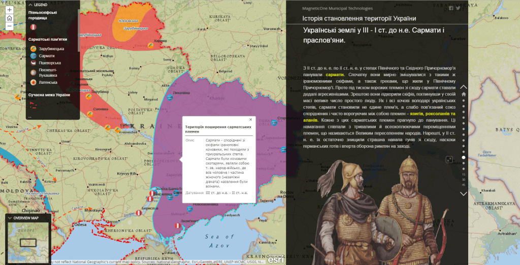
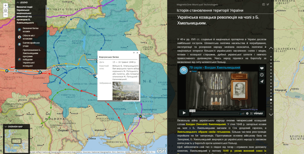
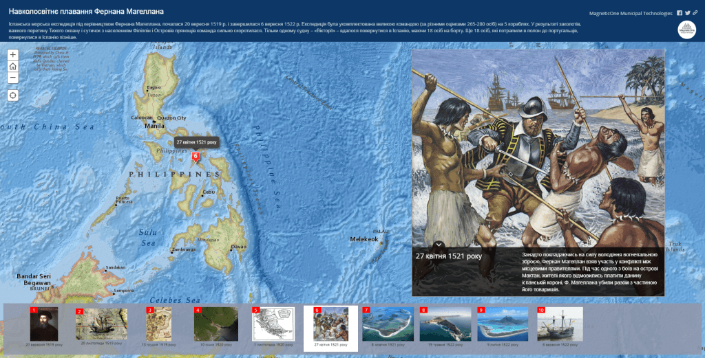
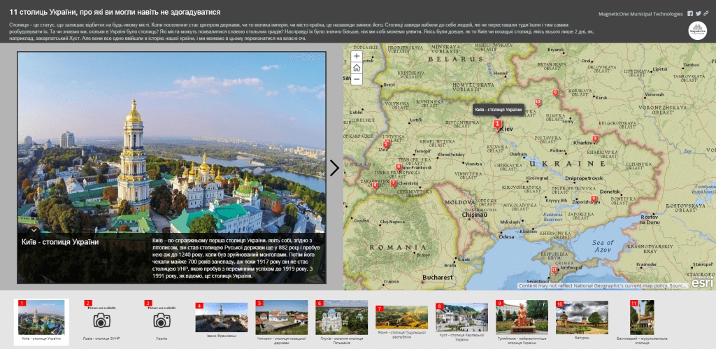
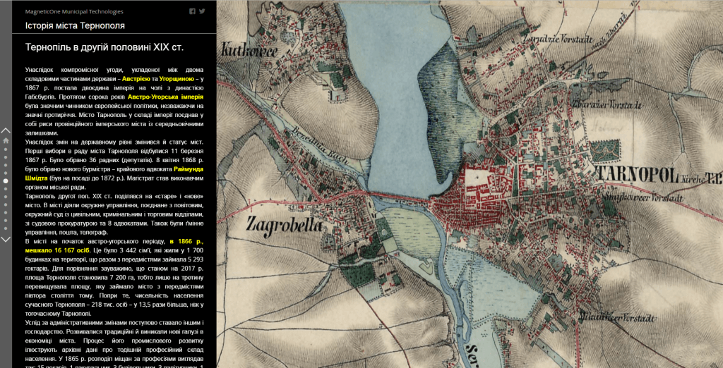
M1MT: Interactive educational map is an electronic mapping resource of the next generation which combines features of an electronic textbook and mapping guide for studying and improving knowledge of school subjects. Developed on the basis of modern technologies, the educational resource meets the requirements of the curriculum of a certain course. It is a visual educational tool which, by combining different forms of comprehension, helps a teacher to prepare and conduct lessons in computer class, using a multimedia projector and interactive whiteboard so that students could deepen their knowledge of geography and develop spatial competence.

Advantages of the interactive map

  • user-friendly, intuitive interface that resembles the main elements of popular programs and does not require any additional study of computer technologies for its usage;
  • demonstration features are supplemented with additional information in the form of tables, charts, diagrams, a vocabulary of terms, slides, video materials, animations, etc.;
  • the fullest set of functions of the mapping part of the resource: map navigation, getting detailed information about each element on the map;
  • constant operational readiness of the resource also via mobile app or mobile version of the resource on your smartphone;
  • availability of service support on interactive map usage (features and purpose of the main menu options and operating menu tools) – as elements of the interface;
  • for its usage, there is no need in installation, separate disk, flash drive or any other information carrier.
Інтерактивна навчальна карта

Advantages of using the interactive map for a teacher

  • combine various forms of presentation (audiovisual, cartographic and text information) for better comprehension by students;
  • enrich your own pedagogical experience and implement principles of developing and personalized learning;
  • improve the level of teaching the subject by increasing the information content of the material while ensuring simplicity and ease of comprehension of the material via the map;
  • increase the effectiveness of lessons, reduce time spent on learning new material, develop spatial competence, artistic skills and creativity of students;
  • reduce the costs spent on updating the visual materials of school by integrating electronic maps in the learning process.

Possible options for integrating the interactive map for school subjects

  • General geography;
  • Geography of the continent and the ocean;
  • Social and economic geography of the world;
  • Social and economic geography of Ukraine;
  • Natural science;
  • Ecology;
  • Economy;
  • History of Ukraine;
  • World History;
  • History of art;
  • History of religion;
  • Regional studies and geography of the native landscape;
  • History of culture;
  • Culturology;
  • Cognitive science and etc.
Інтерактивна навчальна карта

Cost and terms of performance

Calculation of the cost of creating an interactive learning map is based on the price of software, the number of slide maps and objects that need to be placed on the map, as well as the personal requests of the customer. The terms for web-map development will be up to 30 days from the date of providing materials necessary for the development of the map and signing a cooperation agreement.

Services which will be provided prior to implementation of the map

  • Consulting
  • Scanning of paper documents and maps
  • Georeferencing of cartographic materials
  • Digitization
  • Provisioning of interactive map database
Коротка інформація

[contact-form-7 id=”10714″ title=”Форма партнерства”]


×
This site is registered on wpml.org as a development site.