M1MT: Public service management

Управління комунальним господарством

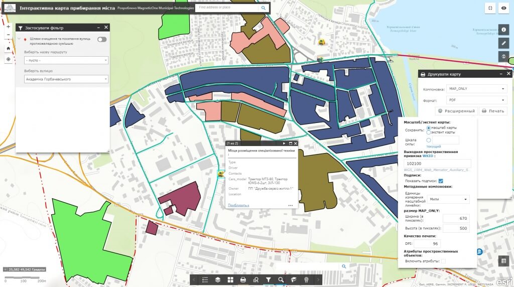
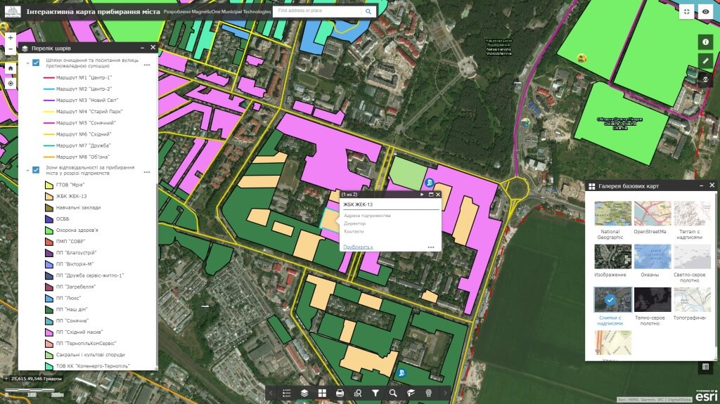
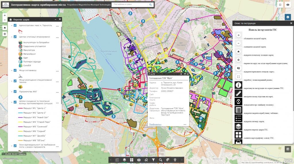
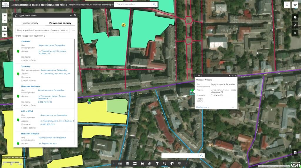
M1MT: Public service management is a municipal geoinformation resource, which, by means of a GPS monitoring, reflects the activity of utility equipment. Monitor location of passenger transport, special equipment (garbage, snow removing and asphalt laying machines, graders, etc.), emergency city services (fire-fighters, ambulance, police) that are responsible for cleanliness, safety and comfort of the city in real time. The main task of the product is to improve the efficiency of public services, avoiding extra costs, proper distribution of equipment and time in everyday work and extreme situations.

M1MT: Public service management provides public access to the mapping database published on the Internet through cartographic apps – the geoinformation system and a synced mobile app for the heads of executive bodies and city residents. GIS contributes to the improvement of standards of living of the citizens, quality of services provided by communal services, who operate the equipment, efficient management of the economy and industry of recreation, sports and leisure of the residents.

Feel the advantages of using GIS for urban passenger transport control

  • monitor location of vehicles on the map in real time;
  • improve traffic routes in emergency situations (traffic accidents, damage of power lines, flooding, etc.);
  • track unauthorized deviations from the route, long stops, etc.;
  • control adherence to the timetable of urban transport (determine the time of advance/delay, number of vehicles on the route, etc.);
  • carry out supervisory control and track the time when vehicles go on the route due to the developed schemes with account for failures and renewal of traffic.
Управління комунальним господарством

Improve work of the city garbage collection and snow removal equipment by means of GIS

  • exclude 100% of non-target roots, reduce fuel consumption, reduce repair and maintenance expenses for all the vehicles;
  • carry out rational distribution of equipment depending on the workload and priority of tasks;
  • control the route of special equipment in “online” mode, correct the track as it is necessary;
  • increase the service life of special equipment;
  • аnalyse performance of workers by keeping track of the equipment movement history with reference to the map;
  • support the optimal amount of special equipment.

Improve the efficiency of city emergency services by means of public service management

  • carry out operational control and supervisory control over emergency services;

  • increase the speed of response, shorten the time for departure organization;

  • reduce fuel consumption due to the effective optimization of traffic routes;

  • monitor work time of employees and brigades;

  • automate statistical information on emergency services with reference to the territory.
Управління комунальним господарством

Create a comfortable urban environment by using the geoinformation system

  • inform executive authorities about the poor performance of public services, assess the quality of provided services;
  • promptly inform public services about emergencies on roads, adjacent areas (break of water pipes, flooding, blackout);
  • mark and take photos of unauthorized garbage collection areas, constant violations of law and order as well as traffic regulations, improperly parked vehicles, etc.;
  • offer places for putting new road signs, reduce the number of road accidents;
  • monitor location of snow and garbage collection equipment, ambulances and public transport in real time.

Thus GIS allows you to process hundreds of similar requests, collect data about the problem and monitor its solution more effectively.

A public service equipped with the geoinformation system and residents of the city will get the following benefits

  • timely provision of housing and communal services by up to 35%;
  • reduction of fuel consumption by 20%;
  • reducing the number of unscrupulous street cleaning by 20-25%;
  • exclusion of any fraud involving fuel theft and unauthorized trips;
  • detection of unscrupulous workers, increase of discipline among employees.

Implementation M1MT: Public service management thereof will be noticeable from the first days of its exploitation.

Services to be provided prior to GIS development

  • Consulting
  • Scanning of paper documents and maps
  • Georeferencing of cartographic materials
  • Digitization
  • Provisioning of interactive map database
Коротка інформація

[contact-form-7 id=”10714″ title=”Форма партнерства”]


×
This site is registered on wpml.org as a development site.