M1MT: Interactive map of mineral deposits – is a web-mapping resource that provides for the accumulation, processing, storage and operational representation of mineral deposits at the level of a territorial community or administrative district (oblast). The electronic map contains information about the quality, quantity and degree of knowledge of minerals in fields of industrial importance, their location, level of industrial development, as well as information about the production, losses and security of social production of proven mineral reserves.
M1MT: Interactive map of mineral deposits
Features of the interactive map
- targeted management of the process of subsoil use;
- detailed analysis of the condition of the state subsoil fund;
- an assessment of the current state (the quantity and quality of stocks of raw materials) and prospects for the development of the extractive industries;
- transparency in the issues of the effectiveness of the representation of the interests of urban residents by the relevant authorities or local self-government, accessibility to the public;
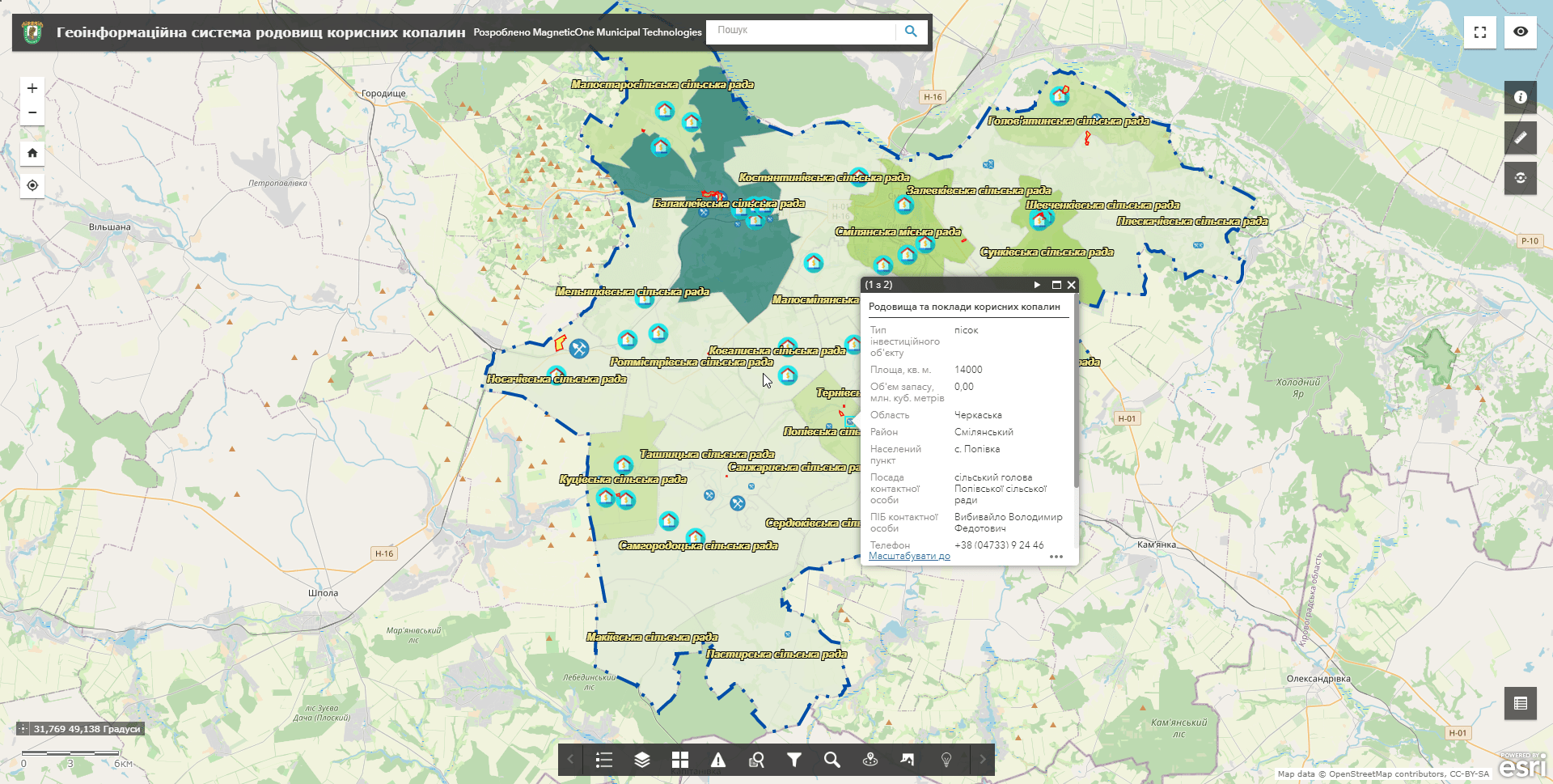
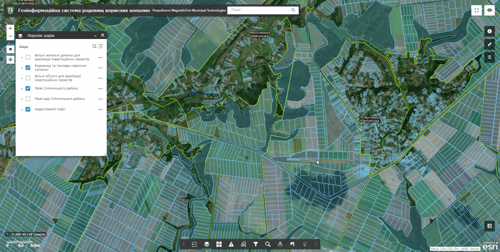
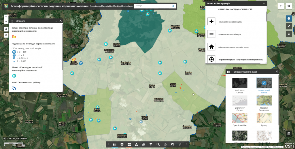
- navigation, data editing, operating with vector layers and cartographic basis, spatial analysis, address search by fields, etc .;
- the user does not need specialized software and cartographer qualifications for work, it is enough to have a web browser and an Internet connection;
- database management, the process of filling and updating the resource can be carried out from a mobile device (smartphone, tablet) through a mobile mapping app.
Interactive map of mineral deposits – an effective management tool for subsoil use
- get systematized information on the quantity, quality, degree of geological and technical-economic study of mineral resources of the territorial community, administrative region;
- analyze the level of industrial development of the subsoil;
- get information on production/losses, for making management decisions on the security of the region`s economy with proven and probable reserves of mineral raw materials;
- make a sound development of plans for the development of the mining industry and directions for further geological study of the subsoil;
- ensure rational and integrated development of deposits in the process of their industrial use;
- provide reference information services to users by providing information on requests in the form of passports or their individual parts (sections, tables);
- conduct operational electronic audits of environmental management at mining sites, detect violations of subsoil use with the ability to leave a photo fact, the coordinates of the relevant incident, and etc;
- create an accessible environment for attracting investment by visualizing mineral deposits available for investment.

Set of interactive map layers
- administrative and territorial structure (borders of regions, districts, united territorial communities, settlements);
- natural conditions and resources (hydrographic objects, soil and vegetation cover, terrain relief, etc.);
- solid combustible minerals;
- metallic minerals;
- mining, chemical and mining minerals;
- non-metallic minerals for metallurgy;
- building minerals;
- drinking and technical waters;
- heat power mineral waters;
- mineral mud and silt.
Requirements, cost and timing of the order
The cost of creating an interactive map of mineral deposits is calculated taking into account a number of parameters: the area of the study area, the number of thematic map layers, the number of mineral deposits, the branching of the database, and individual customer wishes. The deadline for creating a web map is up to 30 days from the date of the provision of the necessary materials and the signing of a cooperation agreement.


