Geoinformation system environmental safety of the city

Геоінформаційна система екобезпека міста

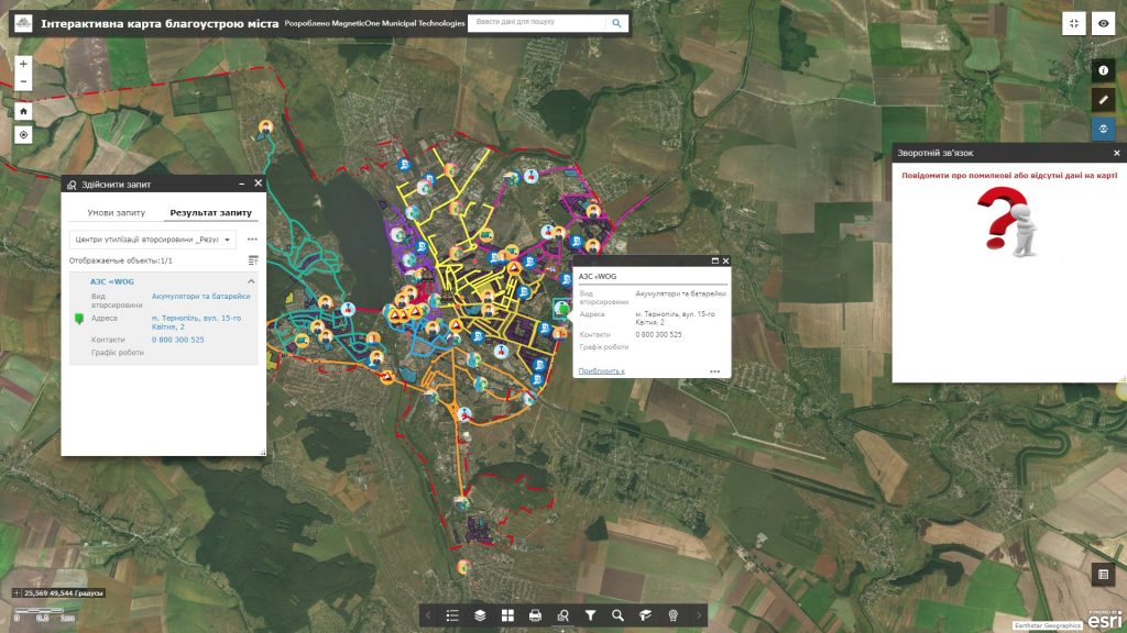
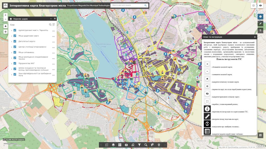
Address the issues of managing environmental safety of the city, reduce environmental risks and ensure ecological balance on the basis of the latest achievements of cartography and geoinformation technologies. Display information on the environmental status of the atmospheric air, soils, aquatoria, geological and hydrogeological situation, and environmental measures aimed at improving environmental situation of the city with a geographic information system and a synced mobile app, a subsystem of electronic queries of the citizens and a platform for their operational analysis.

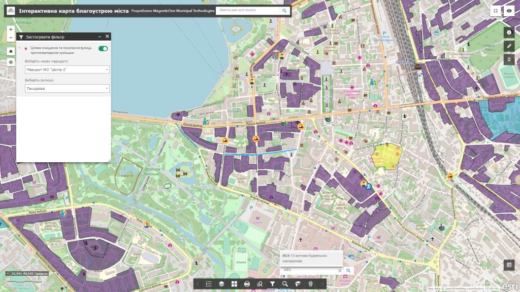
The main task of the GIS is environmental safety of the city for administrative authorities of city administration is to provide the function of information support for decision-making in the field of environmental safety of life of the citizens. Experience the advantages of implementing the solution through the system of electronic queries of the citizens: mark on the electronic map places of unauthorized garbage collection, discharge of sewage into the river, cutting of trees, absence of garbage containers, etc. Get up-to-date data on existing urban issues and check the process of their addressing.

Modern technology solutions on guards of ecological safety of the city

  • monitor and control the current state of the environment in the city;
  • maintain an up-to-date database of the excess of the maximum permissible concentrations of harmful substances within the city;
  • display dynamics of chemical contamination of soils, surface and groundwater, air and vegetation with heavy metals, radionuclides, oil products, etc.;
  • monitor and control development of adverse and dangerous geological and geomorphological processes (ravines, landslides, karst, surface subsidence, flooding, etc);
  • receive prompt information on the zoning of the city (industrial-warehouse, industrial, residential, nature protection territories, etc.);
  • monitor engineering and transport communications (highways of ground and underground transport, heating pipes, power lines, etc.);
  • get objective information on the ecological status of the city as a surface on the basis of multidimensional environmental information.
Геоінформаційна система екобезпека міста

Optimize the performance of the city authorities by the implementation of GIS

  • automate the reporting on the results of social-ecological work;
  • plan social development programs (annual, quarterly), study the quality of life of the citizens, increase the environmental safety of life of the population;
  • manage everyday administrative activities (consideration of claims, complaints, conflicts) through the system of queries of the citizens;
  • ensure collection of objective information on environmental aspects of the industrial activity of the object of environmental inspection by means of a built-in GIS module of audits.

An approximate structure of GIS ecological safety of the city database

  • basic GIS resources: a single cartographic basis with a register of geographical names (streets and rivers), a network of buildings and constructions;
  • thematic information resources: the layers of the map show the ravines, landslides, karst, surface subsidence, floods, sources of pollution (for example, chemical enterprises, nonferrous-metals industry, etc.) and potentially hazardous objects, engineering communications, etc.;
  • task oriented GIS resources as a set of basic and thematic resources, which are united providing new data for addressing problems of territory management, for example, sanitary protection areas around industrial enterprises and potentially dangerous, from environmental point of view, objects, protection areas around sources of urban drinking water supply, nature protection zones, protection areas around utilities lines (gas pipelines, water supply, power lines, etc.).
Геоінформаційна система екобезпека міста

Services which will be provided prior to solution

  • Consulting
  • Scanning of paper documents and maps
  • Georeferencing of cartographic materials
  • Digitization
  • Provisioning of interactive map database
Коротка інформація

[contact-form-7 id=”10714″ title=”Форма партнерства”]


×
This site is registered on wpml.org as a development site.