City audit and inspection platform

City audit and inspection platform is a modern solution for managing property and production assets of state utility companies, municipal operational services, as well as private enterprises operating in the field of public service. Implementation of the platform is aimed at the informational inventory of municipality problem areas (potholes on roads, lack of pedestrian crossings and inspection wells hatches, places of unauthorized waste storage, cutting trees, etc.) by means of mobile application equipped with a powerful geographic information platform. The system allows local authorities to release information about activities of city communal services and receive feedback from citizens on the quality of provided services in user-friendly form (for auditors, inspectors and citizens).

Features of the platform

  • visualization of the actual state of property and production assets of the municipality on the electronic map;
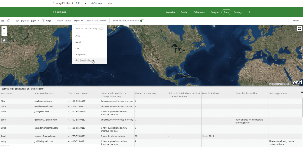
  • operational access to the materials of previous audits and inspections of the urban environment;
  • ensuring the reliability of remote workers reporting (auditors, inspectors, etc.);
  • participation effect and completeness of information perception when managing production and property assets remotely;
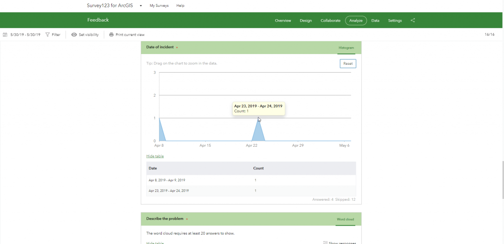
  • an option to provide a photo-report of the problem, in addition to the text of the audit, to pass for processing exact coordinates of the incident, and evaluate the urgency of the solution;
  • filtering auditors reports according to the specifics of the problem (maintenance of housing, roads, sidewalks, streets, city lighting, traffic lights and traffic signs, green areas and city plantations, etc.), the urgency of its solution;
  • monitoring and prompt response to incidents, ability to process large volumes of queries, collect data on problems and monitor their solution

Advantages of using the platform for municipality management

  • get information on the quality of duties performed by remote staff;
  • control the activities of mobile workers (auditors, inspectors), identify dishonest employees and increase discipline within the team;
  • get reliable, documented justification for making managerial decisions thanks to the possibility of creating a photo-report of the problem and criticality assessment of its solution;
  • detect the improper state of equipment and tools that directly affect the comfort and safety of citizens (for example, confirmation of safety compliance of buildings, structures, adherence to fire safety requirements, the reliability of fire hydrants);
  • monitor the dynamics of quality changes for the services provided.

Increase the level of citizens involvement to the process of forming the quality of the urban environment

  • inform executive authorities about the poor performance of public services, assess the quality of provided services;
  • promptly inform public services about emergencies on roads, adjacent areas (break of water pipes, flooding, blackout);
  • mark and take photos of unauthorized garbage collection areas, constant violations of law and order as well as traffic regulations, improperly parked vehicles etc.;
  • offer places for putting new road signs, reduce the number of road accidents.

The basic composition of the platform

  • the subsystem of displaying analytical and statistical data with a selection of appropriate visualization criteria;
  • the subsystem of public electronic queries and registration of incidents by citizens according to the areas: improvement of the street and road network, adjoining territory, maintenance of green plantations, exploitation and repair of housing, maintenance of engineering networks, etc.;
  • the subsystem of the planned audit of the city by mobile workers (inspectors) and relevant operational services (fire audit, production safety audit, environmental audit, drinking water quality audit, green zones audit, etc.).

Cost and terms of the order

Calculation of the cost of audit and inspection platform implementation will be agreed with the customer individually. The term of development will be up to 30 days from the moment of submitting materials necessary for the implementation and signing a cooperation agreement.

Services which will be provided prior to the solution

  • Consulting
  • Scanning of paper documents and maps
  • Georeferencing of cartographic materials
  • Digitization
  • Provisioning of interactive map database
Коротка інформація

[contact-form-7 id=”10714″ title=”Форма партнерства”]


×
This site is registered on wpml.org as a development site.